


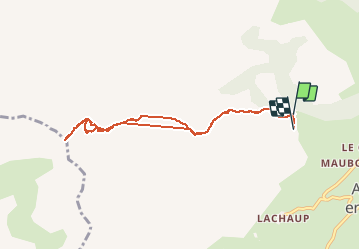

10.2 km | 19.2 km-effort

User


FREE GPS app for hiking
 SityTrail
IGN / Geographical institutes
SityTrail World
The world is yours!
Trail Walking of 8.4 km to be discovered at Provence-Alpes-Côte d'Azur, Hautes-Alpes, Le Dévoluy. This trail is proposed by Dervalmarc.
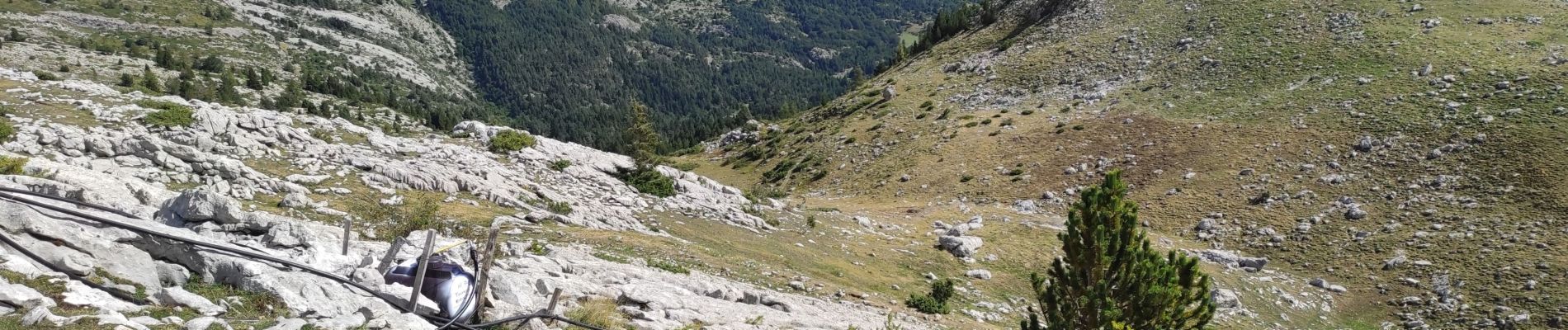
Attention certains passages peuvent impressionner.
Bien assuré son pas dans la montée sous le col sans nom.


Walking

Walking

Walking

Walking

Walking

Walking

Walking

Touring skiing

Touring skiing